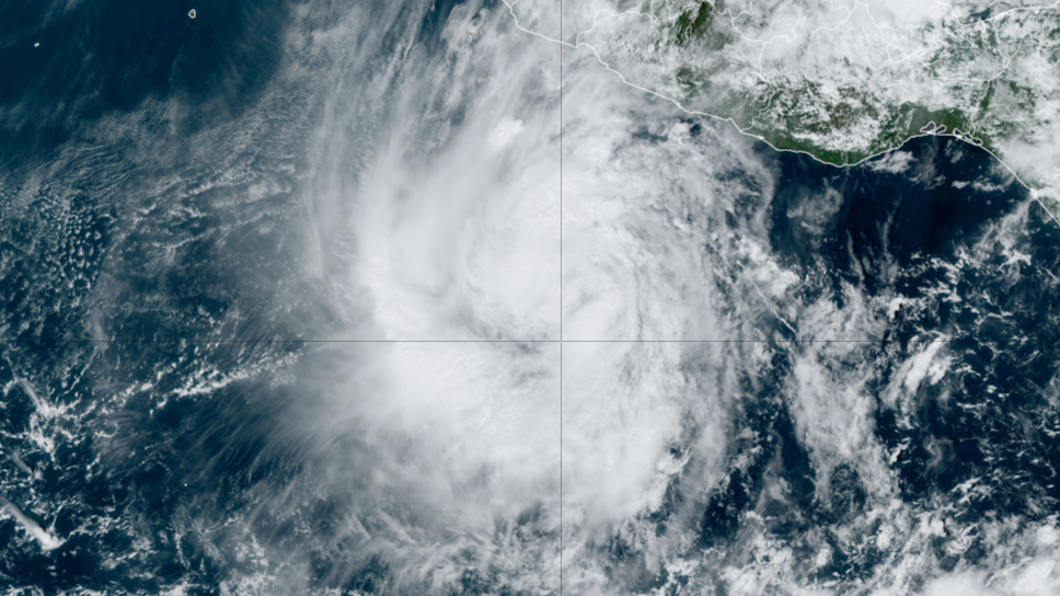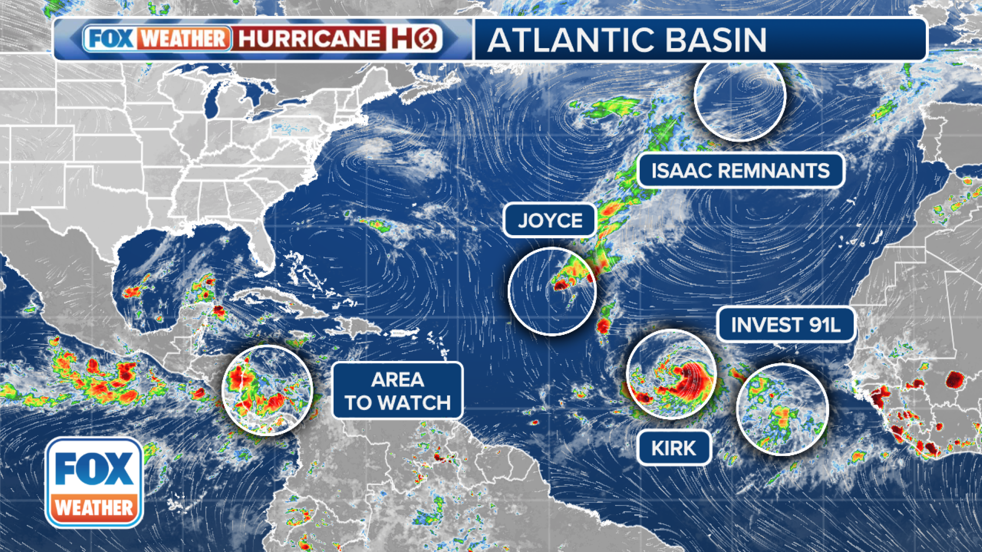
MIAMI – As the Southeast continues to grapple with Hurricane Helene’s aftermath, the Gulf Coast is now facing the threat of another tropical system. The FOX Forecast Center said a similar weather pattern to the one that spawned Helene is developing in the western Caribbean, raising concerns about the potential for another storm to form and enter the Gulf. HOW TO WATCH FOX WEATHERWhile the overall pattern resembles that of Helene, several key differences suggest a potentially weaker storm. The Central American Gyre (CAG), a crucial factor in Helene’s development, is not as strong this time, the FOX Forecast Center said.Tropical Storm Kirk formed in the eastern Atlantic on Monday and is expected to intensify into a hurricane. The system is currently moving westward, but a change in steering currents may cause it to track more northward later this week.Conditions are favorable for strengthening, with low wind shear and warm ocean temperatures. However, the storm’s inner core may need time to develop fully, potentially slowing its initial intensification. Computer models suggest Kirk could become a hurricane within a couple of days and a major hurricane (Category 3 or higher) this week.DOWNLOAD THE FREE FOX WEATHER APPAnother disturbance is slowly organizing to the east of Kirk. It was designated Invest 91L on Monday. An invest is a designation used by the National Hurricane Center to indicate areas that are being closely monitored for potential development.Upper-level winds are forecast to become more conducive for the gradual development of this system, and a tropical depression could form during the middle or latter part of this week while it moves slowly westward or west-northwestward over the eastern tropical Atlantic. Long-range forecasts show the storm potentially becoming a hurricane in five to seven days. It is too soon to say whether it will affect land.Joyce is on its last legs as wind shear continues to rip apart the system. The storm should degenerate into a remnant area of low pressure soon.Isaac transitioned into an extratropical storm Monday. The thunderstorms around its center have mostly dissipated, and the system appears to be developing warm and cold fronts, the FOX Forecast Center said. The storm is expected to be absorbed into a larger low-pressure system over the North Atlantic in the coming days.