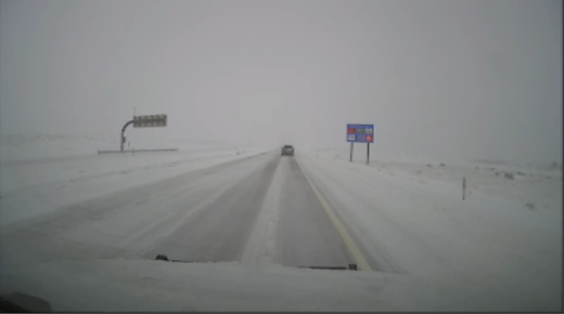
LITTLETON, Colo. – A potentially historic winter storm is dumping snow on New Mexico and Colorado.The FOX Forecast Center reports that the storm will pummel the mountains of New Mexico with extreme snow not seen in November in years.It’s expected to cause impossible travel conditions along Interstate 25 and Interstate 40 in New Mexico heading into Saturday. I-40 was already closed north of Santa Fe, New Mexico, on Thursday, according to the State Department of Transportation.The National Weather Service in Albuquerque reported that over 100 vehicles were stranded on state highways Thursday afternoon.Portions of I-70 in Colorado were shut down Wednesday due to the same system.”By the time the storm ends, we could be talking about snow totals as high as 6 feet along the eastern slopes of the Sangre de Cristo Mountains,” FOX Weather Meteorologist Stephen McCloud said.TIPS FOR DRIVING IN THE SNOWSouthern Colorado is also in the thick of the storm Thursday. South of Denver, in Littleton, Colorado, FOX Weather Meteorologist Craig Herrera reported light “champagne” flakes in the morning but expected heavier, wetter snow as Saturday approaches.Thursday afternoon, New Mexico’s Department of Transportation shut down the Raton Pass through the Sangre de Cristo Mountains on I-25, which connects the state with Colorado.An Emergency Blizzard Warning was issued by the National Weather Service in that area until 8 p.m. local time on Friday.Meteorologist Craig Herrera believed the best day to travel would be Sunday.FOX WEATHER IS YOUR WINTER STORM HQNew Mexico’s largest electricity provider, Power New Mexico, reported that the storm caused widespread power outages across the state on Thursday. According to the company’s outage map, at least 43 thousand customers had been impacted by the afternoon. Many of those outages did not have timetables for restoration. HOW TO WATCH FOX WEATHERThe Denver metro area experienced a lull in accumulation on Thursday, but conditions are expected to further deteriorate from Thursday into Saturday as the storm moves back north, with the heaviest snow expected Friday night.
/
November 7, 2024
Blizzard Warning issued as potentially historic winter storm slams New Mexico, Colorado


