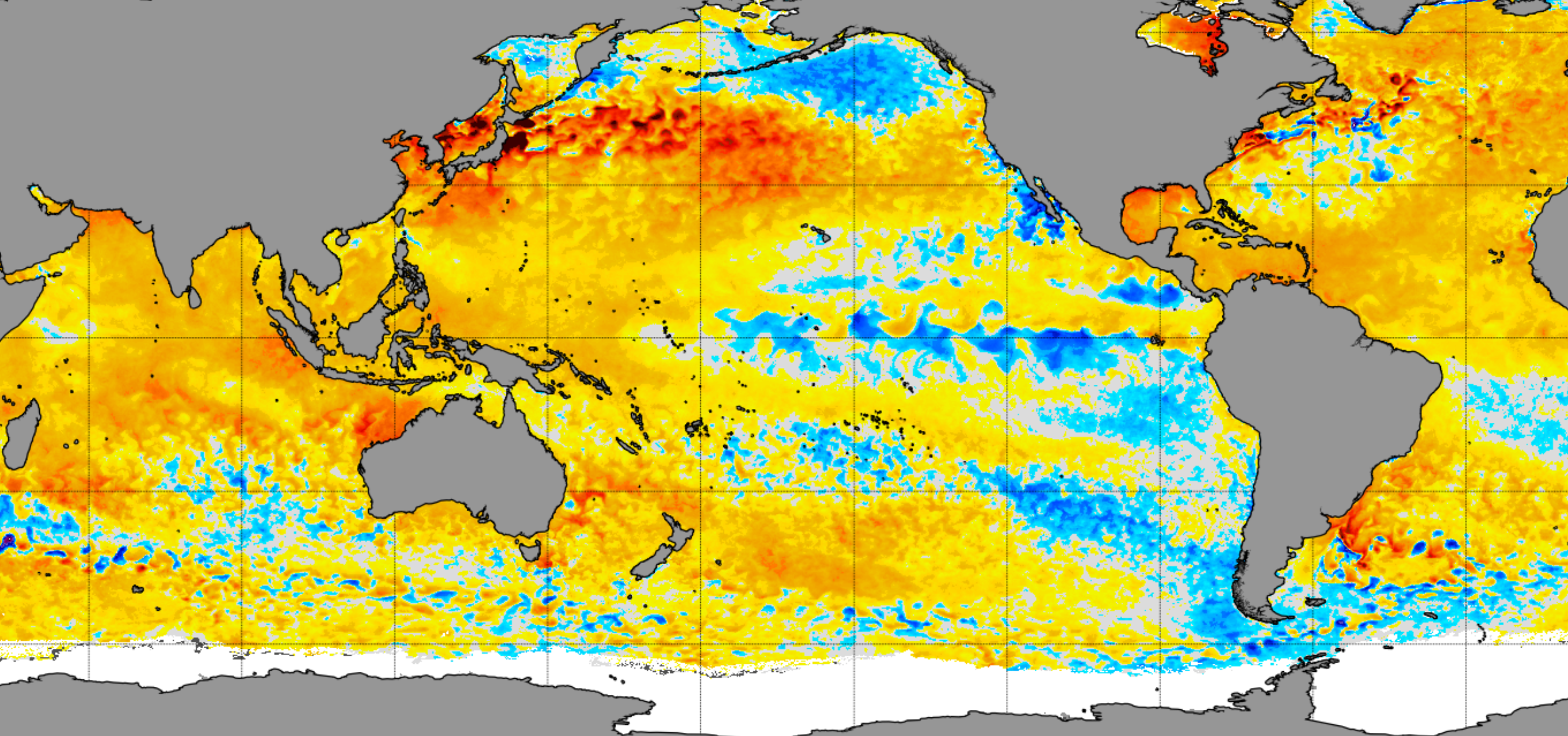
Climate experts are eagerly awaiting the declaration of a La Niña, but the global weather pattern may be weak or may not emerge at all, potentially impacting global weather patterns.The world has been stuck in a neutral status of the El Niño-Southern Oscillation (ENSO) since early summer, as sea surface anomalies have waxed and waned in the region between -0.5°C and 0.5°C over the Pacific.In recent months, cooler-than-average waters have been detected by satellites over the central and eastern tropical Pacific but have not reached the threshold to declare a La Niña event to be underway.These conditions have created variable weather patterns across the world—a situation that may persist through much of 2025, according to long-term climate models.Earlier in 2024, most models indicated that the world would dip into a La Niña, and a significant one at that. However, fewer and fewer model runs are now predicting this scenario.A significant minority of model runs now keep the world in a neutral status for the foreseeable future, impacting weather extremes during the upcoming winter, spring and beyond. Periods of weaker-than-usual trade winds over the tropics have allowed the Pacific to warm slightly, delaying the evolution of a La Niña event.WHAT ARE EL NIÑO AND LA NIÑA CLIMATE PATTERNS?The combination of pockets of warming in the Pacific and the output from computer models gives forecasters confidence that a significant La Niña is not in the cards for many months to come.A neutral winter means neither El Niño nor La Niña conditions are in control, and generally results in more zonal jet stream patterns. This leads to less extreme cold outbreaks across the northern U.S. and average precipitation levels across the southern tier of the country.A La Niña winter typically results in much colder and snowier conditions across the nation, but again, this does not appear to be in the cards for the 2024–25 season, which begins on Dec. 1.The 2023–24 El Niño brought one of the warmest and least snowy winter seasons on record across the U.S., with temperatures more than 5°F above normal values.While the upcoming winter is expected to be somewhat cooler, it is not anticipated to set any widespread cold-weather records.The combination of the ENSO status and general climate warming is expected to keep temperatures above average across a large part of the country. The last time the country experienced a cooler-than-average winter was in 2013–14, when the average temperature was nearly one degree below typical values.According to a NOAA database, the coldest winter on record was 1978–79, with the winters of 1935–36, 1898–1899, 1909–10, and 1904–05 rounding out the top five coldest winters.LITTLE-KNOWN WEATHER PATTERN WHEN EL NIÑO AND LA NIÑA ARE NO LONGER IN CONTROLSome forecast models indicate that an El Niño could return in 2025, but again, climate patterns don’t seem to be in a rush to venture into one extreme or another.Since reliable observations of the ENSO began in the 1950s, there have been only a few occasions when a double El Niño has formed. The period from 1991 through 1995 was marked by a double El Niño, with an extended streak of neutral conditions from 1992 to 1994.A major unknown is the impact of climate change on the behavior of ENSO. Rising ocean temperatures are likely to increase the frequency of El Niño events, but more research is needed to understand how warmer seas will influence the changes in the world’s ENSO status.NOAA provides monthly updates on the status of ENSO, released on the second Thursday of each month.
/
November 14, 2024
Decreasing confidence that a significant La Nina event will ever unfold over the Pacific

