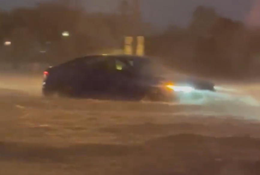
NEW ORLEANS – Louisiana residents were on high alert for flash flooding, as forecasters predict heavy rainfall from showers and thunderstorms could bring several inches of rain over the next 24 hours.National Weather Service offices serving the Gulf Coast region issued Flash Flood Watches for over 3 million residents, while NOAA’s Weather Prediction Center has highlighted a moderate risk for flooding around New Orleans and surrounding parishes.An old, stationary front is expected to serve as a focal point for the showers and thunderstorms, which could persist into Sunday and potentially drop up to 7 inches of precipitation in some areas.”Excessive runoff from these storms could lead to the flooding of low-lying and flood-prone areas,” forecasters warned.One of the hardest hit communities appeared to be Baton Rouge, where a Flash Flood Emergency was issued on Saturday, and motorists appeared to be stranded along the Interstate 10 corridor.The storm system’s arrival coincides with already saturated grounds from previous rainfall, leaving little room for additional water storage and poor drainage.SOUTH TEXAS RESIDENTS PLUCKED FROM HOMES AMID DEADLY FLOODING AND TORRENTIAL RAINSFlood warnings are currently in effect for rivers in Texas, Louisiana, and Mississippi, where several days of heavy rainfall have already caused flooding.At least three people died in Texas last week as record flooding impacted border towns west of Brownsville, where 10-15 inches of rain fell.Local authorities in McAllen, Texas, performed hundreds of rescues as vehicles and some structures became submerged in water.The New Orleans NWS office is warning that flooding could have a significant impact on urban areas, particularly those with poor drainage systems.HOW TO WATCH FOX WEATHERFlood Watches were expected to remain in effect through Sunday morning but may be extended depending on the amount of rainfall that accumulates.The region is also bracing for additional showers and thunderstorms on Monday as a significant cold front moves through, bringing the threat of severe weather to much of the heartland.NOAA’s Storm Prediction Center has issued a Level 2 out of 5 on its severe storm scale for New Orleans, warning of the potential for damaging hail, strong winds and tornadoes.Most of the energy associated with the secondary storm system will stay north of the Gulf Coast and target communities in the Tennessee Valley.

