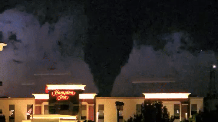
A widespread and dangerous severe weather outbreak is expected to develop into the weekend as a powerful storm system unleashes its fury across the central and eastern U.S., impacting more than 150 million people. The Storm Prediction Center upgraded Saturday’s risk to its highest level as a tornado outbreak is now expected. The FOX Forecast Center said that multiple days of potent thunderstorms could bring destructive straight-line winds up to 100 mph, hail up to the size of baseballs and significant long-tracked tornado activity (EF-3 or higher).”This storm has it all,” Bill Bunting, operations branch chief for NOAA and the National Weather Service Storm Prediction Center (SPC), told FOX Weather. “The moisture is plentiful. And so our fear is all of these ingredients – the wind shear, the moisture, the lift – are going to combine to produce a very explosive and potentially deadly attack beginning this afternoon, continuing overnight and also on Saturday as you look farther south and east.”Severe Thunderstorm Watches were issued from Minnesota and Wisconsin southward to Missouri due to the threats of damaging hail and wind.Tornado Watches were issued for a large part of Missouri, Illinois and Arkansas until close to midnight, which included the St. Louis metro.Additional watch boxes extended all the way to the Gulf Coast, with some communities under what is considered to be a ‘Particularly Dangerous Situation’ Tornado Watch.A PDS Tornado Watch is issued when the forecaster has high confidence that multiple violent tornadoes will occur in the watch area.DOWNLOAD THE FREE FOX WEATHER APPWind damage was reported in northwest Missouri, where first responders say part of a shopping center collapsed in the town of Trenton.There were no reported injuries from the collapse, but extensive power outages were reported in the region.The first Tornado Warning of the event was issued outside of Springfield, Missouri, on Friday evening, but there was no indication that a twister caused widespread damage.Anticipating widespread impacts from the severe weather, the governors of both Alabama and Missouri have issued states of emergency for their states.Anticipating widespread impacts from the severe weather, the governors of both Alabama and Missouri have issued states of emergency for their states.On Saturday, the powerful storm system will continue tracking east as a tornado outbreak is possible across the central Gulf Coast states and Deep South into the Tennessee Valley.A Level 5 out of 5 on the severe storm threat level is impacting 2.7 million people in major cities like Birmingham, Alabama, Jackson, Mississippi, Tuscaloosa and Hoover in Alabama and Hattiesburg, Mississippi.WATCH VS. WARNING: HERE ARE THE DIFFERENCES BETWEEN THESE WEATHER TERMS THAT COULD SAVE YOUR LIFEThe storms will develop along the Mississippi River and quickly move east from midday to the afternoon, according to the FOX Forecast Center. The line of supercells is then expected to swing through central and southern Mississippi into northern Alabama, central and east Tennessee and north Georgia. Cities such as New Orleans, Louisiana, and Birmingham, Alabama, are under a Level 4 out of 5 risk, indicating a high likelihood of supercell thunderstorms capable of producing tornadoes and damaging winds. By Sunday, the storm will have traversed the entire U.S. with its eye now on the East Coast, including the Interstate 95 corridor. The threat of tornadoes will be confined to the Virginia coast and south into the Carolinas. Damaging wind gusts and large hail will be the main threats.STAY OR GO? TRUSTING YOUR GUT CAN BE LIFESAVING WHEN MULTIPLE WEATHER WARNINGS ARE ISSUEDLike on Friday and Saturday, plenty of wind shear will be present, allowing any singular storm to rotate and produce a tornado, according to the FOX Forecast Center.North of the Delmarva into the Northeast, severe storms will also be possible.