SIOUX FALLS, S.D. (KELO) — It has been a quiet day across KELOLAND as a high pressure system keeps us dry with plenty of sunshine. Breezy conditions have returned, especially east of I-29 with wind advisories in effect for southwest Minnesota until this evening.
As the low pressure system over the Great Lakes region moves off to the northeast, the wind will go with it. Temperatures will cool into the single digits and teens for the night with cloud cover increasing.
Active weather will move in to start off our weekend with a few flurries possible in southeastern KELOLAND tomorrow morning. Mostly cloudy skies will linger for most areas with highs ranging from the teens to the 30s.
All eyes will be on our next system moving in, with snow starting to move into western South Dakota by late afternoon on Friday, then expanding across northern KELOLAND going into Friday evening. It is likely that the Friday evening commute will be impacted in these areas.
By early Saturday morning, the band of snow will become more widespread and push off into Minnesota going into the afternoon.
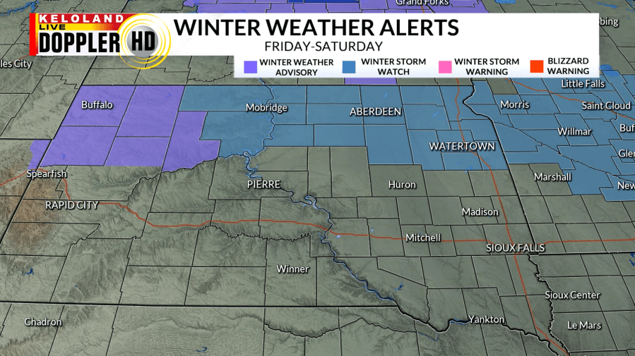
There is a Winter Weather Advisory in effect for northwestern South Dakota starting tomorrow morning through early Saturday morning. These areas could see snow totals around 2″ or greater, with higher amounts near the North Dakota border. The rest of northern KELOLAND will be under a Winter Storm Watch going by tomorrow evening and into Saturday afternoon. Snow totals around 4″ or more are likely in these areas. We will continue to monitor any changes in the track and amounts with this system going into the weekend.
Going into next week, cold air returns with highs falling into the single digits with additional snow chances.