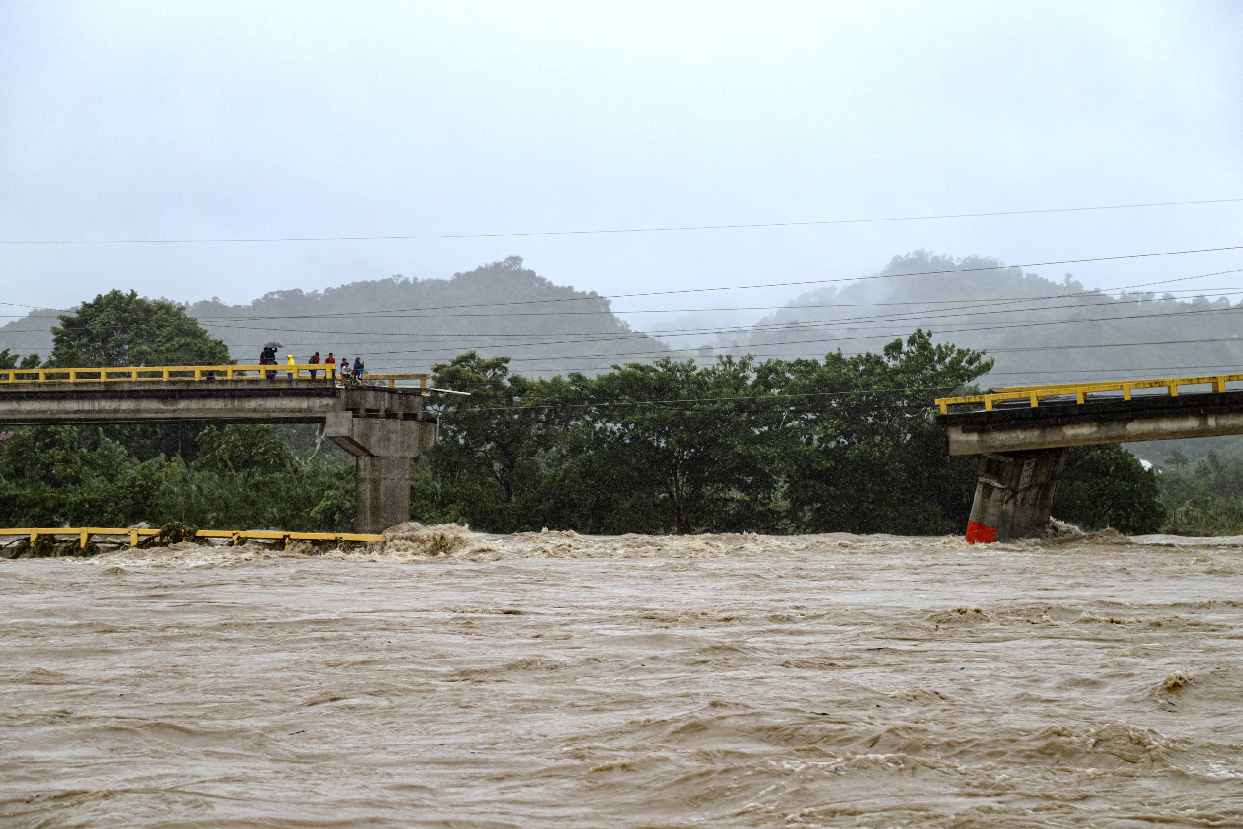
MIAMI – Tropical Storm Sara continues to unleash torrents of rainfall across Honduras as it slowly scrapes along the Central American nation’s coastline, bringing life-threatening and catastrophic flash flooding and mudslides.Sara officially made one landfall Thursday evening, but its center of circulation is forecast to slowly track along the coastline and briefly back out into the Gulf of Honduras on Saturday and then into Belize on Sunday.The slow moving storm combined with the steep terrain of the region is a destructive combination that has led to feet of rain falling in short periods of time.Over 25 inches of rain have fallen in La Ceiba since Thursday. The country’s emergency management agency said at least 86 homes and residences have been damaged and more than 32,000 people had been affected. The nearby Cangrajal River wiped away part of the Saopin bridge in La Ceiba.This video by Honduras’s national police shows road conditions as officers patrolled the town:Government officials in Honduras have been urging residents living along the banks of rivers and in other low-lying areas to prepare for an onslaught of rainfall and potential flooding.TROPICAL STORM SARA TRACKER: LIVE MAPS, SPAGHETTI PLOTS, FORECAST AND MORETravel around the region has also been impacted. Airports in Roatan and La Ceiba have suspended all operations until at least 6 p.m Friday, according to government officials. Both American Airlines and United Airlines offered to waive some fees associated with changing flights.Cruise lines are also telling passengers with upcoming itineraries in the area to keep tabs on the forecast. “Carnival Cruise Line’s Fleet Operations Center in Miami is actively monitoring the disturbance in the Caribbean,” a spokesperson for Carnival Cruise Lines said in an email to FOX Weather. “Guests are encouraged to opt-in to text alerts when checking in for upcoming cruises and to monitor emails.”YOU HAVE OPTIONS IF A HURRICANE RUINS YOUR VACATION OR OTHER TRAVEL PLANSSara is located northwest of the border between Honduras and Nicaragua and has maximum sustained winds of around 50 mph. When the center of Sara moves over water to the north of Honduras during the next couple of days, some slight strengthening is possible.DOWNLOAD THE FREE FOX WEATHER APPOn the forecast track, the center of Sara will continue to move close to the northern coast of Honduras through early Saturday, then approach the coast of Belize early Sunday, the National Hurricane Center (NHC) said.HOW TO WATCH FOX WEATHEROver northern Honduras, rainfall totals of 15-25 inches, with locally higher amounts of 35 inches, are expected.”This rainfall will lead to widespread areas of life-threatening and potentially catastrophic flash flooding and mudslides, especially along and near the Sierra La Esperanza,” the NHC warned Friday.Other parts of Honduras, as well as Belize, El Salvador, eastern Guatemala and western Nicaragua, could see 5-10 inches of rain, with locally higher amounts of 15 inches, through early next week.Along the northern coast of Honduras, a storm surge of 1-3 feet is possible in areas of onshore winds, and the region should also expect large and destructive waves at the beach.The good news for those monitoring the storm in the U.S. is that the long range forecast is nowhere near as imposing for Sara as it was earlier in the week.Earlier forecasts had Sara staying farther out in the warm Caribbean waters, allowing for further development and potentially eyeing Florida as a major storm next week.However, new forecasts on Thursday and Friday indicate Sara will spend considerably more time near or over land this weekend, significantly dimming its prospects for future strengthening.”We can’t say that there isn’t going to be an effect in Florida, but the odds are very low now of a significant impact from this storm in Florida. And there maybe next to none at all,” FOX Weather Hurricane Specialist Bryan Norcross said. “In fact, if you had to put any odds on it, you’d say a better chance of next to none than certainly a significant storm.”The current forecast cone from the NHC now indicates Sara will not survive its trek over the Yucatán Peninsula and could dissipate from a formal tropical cyclone over the weekend.”And then the question is, what comes out here (off the Yucatán Peninsula)?” Norcross said. “We’re getting into strong upper-level winds and lots of dry air. So the thinking is, even if something sneaks out up there, it’s going to be under hostile conditions. So we’re not looking for any kind of development in the Gulf, almost certainly.”Sara is the 18th named storm of the 2024 Atlantic hurricane season, which runs from June 1 to Nov. 30.
/
November 15, 2024
Tropical Storm Sara slams Central America with catastrophic flooding as airports halt travel

